
| Master Planning for a Hunting, Golf & Equestrian Estate Community Pike County • Missouri • USA • 2008 & 2009 |
W. F. Heartwell Architect |
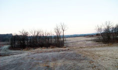
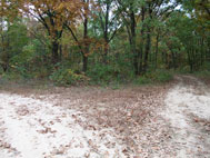
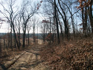
South West Entrance to Site
Highway Beyond
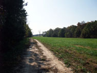
Continuation of North/South Access Road
Proposed Site of Aquatic Center &
Boutique Hotel
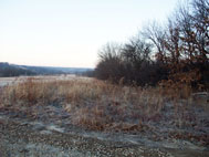
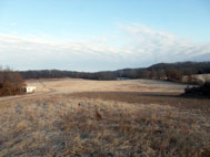
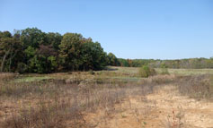
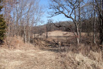
Meadow Stretching South West
Existing Pond
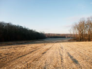
Proposed Location of Second Golf Course
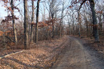
Top of Ridge Looking West
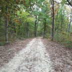
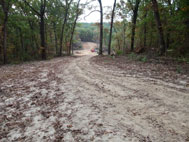
Proposed Location of Main Access Road
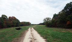
Top of Ridge at Intersection of
The Two Meadows
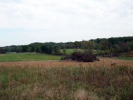
Proposed Site of the Golf Club House
Road Back to
North/South Ridge
Connection to Club House
Top of Ridge Looking East
Proposed Location of the
Equestrian Center
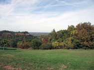
North Meadow
Proposed Site of
18 hole Golf Course
Continuation of
Road West to Main Ridge Road
Connection to Proposed Residential Area
North/South Access Road
Along Ridge
Proposed Residential Area
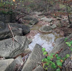
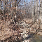
Creek and Water Fall
North of Meadow
Continuation of the Golf Course
Creek and Meadow
North of East/West Ridge Road
Intersection with East/West
Ridge Road
Proposed Second Residential Area
Road Heading North East
Looking Back South to Creek
Continuation of the Golf Course
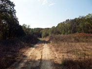
Ridge Road Leading Down to
South East and North East
Meadows
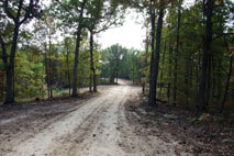
Continuation of North/South
Access Road
Road Diverts to the North & South
North Connects to the County Road
South Connects to Another Meadow
Ridge Road
Connecting to North West Meadow
Creek at Bottom of Road
Second Connection to the Highway
The Site, located about a one hour drive north of St. Louis, Missouri is comprised of 2 parcels of land, totalling approximately 1,200 acres. The closest towns to the site are Hannibal just to the north along the highway, Bowling Green - the County Seat - to the south, and Louisiana to the south east on the Mississippi River. Essentially the property is located in the heart of Mark Twain country.
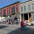
Most architecturally noteworthy, is the City of Louisiana, known for its commercial Victorian Streetscape, also known as the Georgia Street Historical District. As well, many of the private residences are listed on the National Historic Register of Historical Places. Hence, the City is a major draw and has many seasonal festivals. A brief walking tour of the City is presented below.
As for the site, the topography of the land varies greatly with several meadows located between lime stone ridges running both north/south and east/west across the property, with only a small portion of the land suitable for farming. Currently a multi-generation family lives on the property, and the land is mostly used for hunting.
The Project Manager, who is a long time friend of the family, proposed developing the property for recreational use creating an Estate Community which would cater to the residents of St Louis. It would be a condominium development of approximately 50 homes carefully located along the existing ridge roads. All residences would have forest views and minimal overlook to neighbouring homes. The residences would be supported by a small farmers market located near the south end of the property which would also be accessible to the general public. An Equestrian Center would be developed in the southern meadow near the Site entrance and would have direct access to the highway. A Boutique Hotel, an Aquatic Center, and a Golf Club with two 18 hole golf courses would be located at the center of the property. And the northern section of the property would be left for riding trails and hunting. A walking tour of the site is presented above, and essentially follows the existing roads in a figure eight pattern starting at the south west corner of the property.
With the property being accessible on all four sides by existing county roads, and the possibility of future expansion, the property has many potential directions for development. When a large gas pipe line servicing the Eastern US, was installed in the southern meadow, it provided the impetus to further investigate the development potential. The Project Manager, with whom I had consulted with several years earlier on a residential project in California, asked me to be the Design Consultant for the project. I visited the site several times to experience it in different seasons. Each time, in consultation with the Owner, we refined our design direction. Although we were not able to consolidate our concepts in a final design due to the economic downturn, we were able to establish two potential building sites for the Owner's new residences. The first residence would be located in the southern meadow, and would house the Owner's extended family while the second residence would be built. Then the first residence would act as the development office and provide accommodation for visiting consultants.
The second residence would be designed not only for the family but also as a bed and breakfast facility, which would accommodate guests who wished to hunt as well as potential investors visiting the site. Plans for these facilities were well developed but were put on hold until financing could be secured in a healthier economic environment. The residential concepts and selected sites are presented in the following web pages.
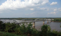
The Mississippi River
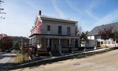
Residence with Additions
Federal Design (Gothic Revival)
Under Renovation
Residence with Additions
Side View
Under Renovation
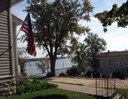
The Mississippi River
View of the Mississippi
from
Second Street
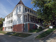
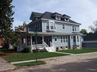
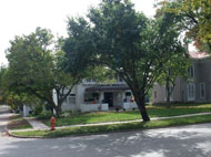
Edwardian Residence
(With Vinyl Siding)
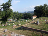
Riverview Cemetery
Overlooking the Mississippi
Victorian Residence
(Italianate Style)
Originally the P. Stark Sr. Residence
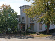
Prairie Style Residence
(Attributed to FLW)
Colorfest Celebrations
Greek Revival
Home
Originally the Lawrence Stark Residence
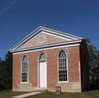
Anglican Church
Greek Revival Style
With Victorian Gothic Windows
Federal Clapboard
With Additions
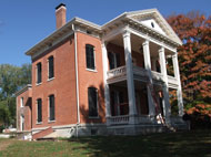
Dr, N. C. Hardin House
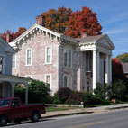
Antebellum Residence
(Greek Revival)
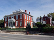
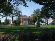
Originally Dr. Keith's Residence
Antebellum Residence
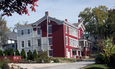
(Greek Revival)
Originally Burns Family Residence
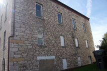
Industrial Stone Work
Antebellum Residence
(Greek Revival)
Originally the Edward McQuie Residence
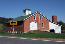
Brick Barn
Belonging to
Antebellum Residence